9196
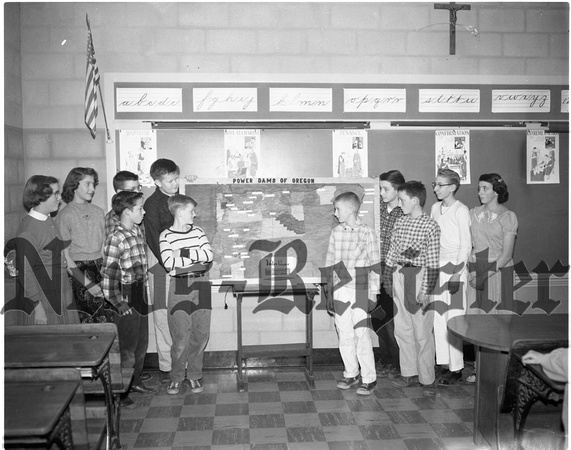
February 4, 1957br/A seventh grade class on Oregon history at St. James school examines a unique map of Oregon power dams recently completed. Dam sites are located on the map with colored lights with federal projects, private enterprises, and dams under construction differentiated by different colors. Built as a class project, the map was drawn, painted, outlines were burned with a wood-burning pencil, and sites were labeled by members of the class. Plywood for the map was furnished by Al Hurl and information for the project was obtained by M. H. McGuire, manager of the city water and light department, From the left are Anne Juenemann, Mary Barrett, Philip Barrett, Glen Juenemann, Kenneth Gorsythe, Mike Johnson, John Hurl, Larry Elliott, Terry Devlaeminck and Carolyn Devlaeminck.